
Real-Time Bus Tracking Platform
Sub-second GPS telemetry, geofence alerts and panic-button routing for parents, drivers and fleet managers.
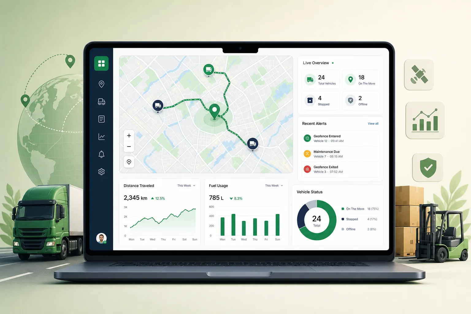
Real-Time Bus Tracking Platform overview
We architected and deployed a real-time transit telemetry platform that captures GPS coordinates from on-bus hardware and delivers them to parents, drivers and fleet managers across web, iOS and Android clients. The engineering objective was a fault-tolerant, low-latency tracking system able to absorb continuous telemetry streams from a large vehicle fleet, with sub-second end-to-end latency from the physical GPS sensor on the bus to the map on the end user's screen.
The work was organised into three engineering stages. Infrastructure modernisation replaced manual host provisioning with declarative, immutable Terraform infrastructure. Pipeline optimisation moved telemetry from synchronous REST endpoints to an asynchronous publish-subscribe architecture built on MQTT and Apache Kafka. Data tier separation isolated the ephemeral real-time positional cache in Redis from the long-term transactional and spatial store in PostgreSQL with PostGIS. Around that core we built an emergency event routing sub-system, responsive web and native mobile interfaces, and a GitOps-managed Kubernetes deployment across AWS and Azure.
Challenge in Transportation operations
The legacy environment we inherited was a monolithic, blocking I/O system. It suffered severe database write contention, had no asynchronous event distribution and used inadequate edge data serialisation. During high-density transit hours the system dropped messages, leaving web and mobile clients unable to reconcile vehicle coordinates in real time. Spatial checks hit the disk-bound database on every ping, and there was no way to prioritise a hardware panic-button press over routine location updates, so a safety alert could sit behind a backlog of ordinary tracking traffic.
The platform also had to serve three very different audiences: parents who need to see one authorised bus, drivers who need route guidance through cellular dead zones, and fleet managers who need to watch hundreds of moving vehicles from a single terminal. Because the system handles private student information, tenant isolation, encryption and audit trails had to be designed in rather than added later.
Solution architecture & delivery
Telemetry ingestion starts at the vehicle. On-bus cellular units publish binary Protobuf payloads (vehicle_id, timestamp, latitude, longitude, speed, heading, telemetry status and checksum) over MQTT with TLS to a Network Load Balancer fronting an auto-scaling, active-active MQTT gateway cluster. The brokers forward raw packets into an Apache Kafka topic partitioned by vehicle_id, which guarantees that all points for a given bus are consumed sequentially and never arrive out of order. Containerised Spatial Processing Service workers on Kubernetes parse each payload, load geofence polygons from a Redis cluster rather than the database, run localised bounding-box checks before executing PostGIS ST_Contains and ST_Distance queries, compute speed, course and heading acceleration, and write a path-deviation record whenever a bus leaves its assigned route. Live positions sit in a TTL-backed Redis cache; historical coordinates are down-sampled with line-simplification algorithms and stored in PostgreSQL tables partitioned by operational week, keeping indices small enough to stay in memory for history replays. Older partitions are detached and exported to compressed cold object storage during maintenance windows.
Emergency handling runs on its own path. A panic-button press flags the packet at maximum severity and the MQTT broker routes it to a dedicated high-priority Kafka topic with an isolated pool of consumer workers, bypassing the standard telemetry queue entirely. The Emergency Event Routing Service extracts the coordinates, looks up the responsible supervisors and dispatch units in the multi-tenant datastore, and broadcasts encrypted alerts simultaneously over three channels: WebSocket pop-ups on the dispatch console (synchronised across nodes through a Redis pub-sub backplane), mobile push through APNs and Firebase Cloud Messaging, and fallback SMS through the Twilio gateway. The documented message flow runs from button press at T=0 ms to WebSocket/FCM dispatch at T=65 ms. The same WebSocket layer uses decoupled connection managers to hold open sessions with hundreds of thousands of concurrent clients and filters outgoing traffic so each user only receives updates for the vehicles they are authorised to monitor.
The interface layer is a single-page web application plus native iOS and Android apps behind an API gateway that splits REST configuration traffic (route schedules, user profiles, Okta OIDC verification) from the WebSocket telemetry stream. Client-side coordinate interpolation smooths vehicle movement between hardware updates, and maps render from lightweight vector tiles to cut mobile data use. The driver app keeps route information in an encrypted local store, queues telemetry and diagnostic logs while offline and uploads them as a differential batch when connectivity returns. Administrative dashboards use canvas rendering so one terminal can track hundreds of assets, with filtering, geofence layer toggles and route optimisation tasks that are offloaded to dedicated worker pools via an asynchronous queue. Everything runs on managed Kubernetes provisioned by modular Terraform across dev, staging and production, with stateless parsers and APIs on disposable node pools scaled by Horizontal Pod Autoscalers on ingress volume, and Kafka brokers and Redis on dedicated node pools with persistent storage. Okta issues signed JWTs whose role claims (parent, driver, administrator) and tenant_id are validated at the gateway; TLS 1.3 protects data in transit, AES-256 with rotated KMS keys protects data at rest, mTLS secures service-to-service calls, CrowdStrike Falcon monitors the worker nodes, and Prometheus, Grafana and PagerDuty handle observability and on-call alerting.
Key features of Real-Time Bus Tracking Platform
- MQTT-over-TLS ingestion of Protobuf GPS payloads through an auto-scaling broker cluster into Kafka topics partitioned by vehicle_id
- Spatial Processing Service with Redis-cached geofences, PostGIS route-boundary checks and automatic path-deviation logging
- Emergency Event Routing Service that bypasses standard queues and alerts dispatchers over WebSockets, APNs/FCM push and Twilio SMS
- Parent, driver and administrator portals with Okta OIDC sign-in and role- and tenant-scoped JWT authorisation
- Driver app with encrypted offline route storage and background differential sync after cellular dead zones
- Fleet dashboard with canvas rendering for hundreds of concurrent vehicles, filters, geofence layers and route optimisation tasks
- Weekly-partitioned PostgreSQL/PostGIS history store with line-simplified tracks and automated cold-storage archiving
- GitOps Kubernetes deployment on AWS and Azure with Terraform, Horizontal Pod Autoscalers, rolling updates and automated database failover
Who this web application is for
The platform is built for transit and school-transport operators who need to give parents a live view of an authorised bus, give drivers dependable route guidance even without coverage, and give dispatchers and fleet managers a single console for monitoring, geofence alerts and emergency response. The same telemetry pipeline suits any operator that must process high-frequency GPS streams from a large vehicle fleet with strict tenant isolation.
Impact & results
- Replaced a monolithic blocking system that dropped messages at peak hours with an asynchronous Kafka pipeline that queues traffic safely during spikes
- Sub-second end-to-end latency from on-bus GPS sensor to end-user display, with emergency alerts dispatched at T=65 ms in the documented flow
- Panic-button events processed on an isolated high-priority path even when routine tracking queues are backlogged
- WebSocket layer sustains hundreds of thousands of concurrent client connections while sending each user only their authorised vehicles
- Weekly table partitioning and a Redis write cache keep spatial indices in memory and write times predictable under continuous inserts
- Automated failover promotes a hot-standby database within seconds, and rolling Kubernetes updates ship changes without interrupting live tracking streams
FAQ about Real-Time Bus Tracking Platform
What problem does the Real-Time Bus Tracking Platform solve?
The legacy tracking system was a monolithic, blocking I/O application that suffered database write contention and dropped messages during peak transit hours, so web and mobile clients could not show live bus positions. We replaced it with a decoupled, event-driven platform that streams GPS telemetry from on-bus hardware to parents, drivers and fleet managers with sub-second end-to-end latency.
Which technologies power the Real-Time Bus Tracking Platform?
On-bus GPS units publish Protobuf payloads over MQTT with TLS into Apache Kafka topics partitioned by vehicle_id. Spatial processing services run on Kubernetes against a Redis cluster and PostgreSQL with PostGIS. Okta and OpenID Connect handle identity, Terraform provisions the AWS and Azure infrastructure, Prometheus and Grafana provide observability, and alerts go out over WebSockets, APNs/FCM, Twilio SMS and SendGrid.
How are panic-button alerts kept from queuing behind routine GPS pings?
When the on-bus emergency button is pressed the telemetry packet is flagged at maximum severity and the MQTT broker routes it to a dedicated high-priority Kafka topic with its own isolated pool of consumer workers. The Emergency Event Routing Service extracts the coordinates, identifies the responsible supervisors and dispatch units, and broadcasts simultaneously to the admin console over WebSockets, to mobile devices through APNs and Firebase Cloud Messaging, and by fallback SMS through Twilio.
What happens when a bus enters a cellular dead zone?
The driver app switches to offline mode, keeps the route guidance available from an encrypted local store and appends telemetry and diagnostic logs to that store while the network is down. It checks connectivity continuously; once a stable link returns, a background synchronisation worker uploads the accumulated records as a differential batch and verifies the queue is empty, so the backend can reconstruct the missing path history.
Real-Time Bus Tracking Platform product screens
Build your next Transportation product with Next Olive
Share your requirements — we will propose scope, timeline and stack within one business day.